
Lawson topographic map
Click on the map to display elevation.
About this map
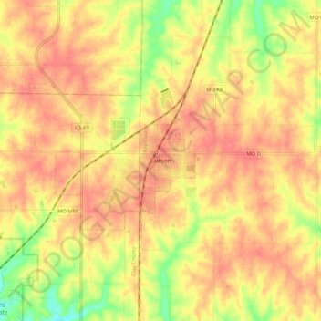
Name: Lawson topographic map, elevation, terrain.
Location: Lawson, Ray County, Missouri, 64062, United States (39.39834 -94.24411 39.47834 -94.16411)
Average elevation: 1,033 ft
Minimum elevation: 906 ft
Maximum elevation: 1,099 ft
Ray County trails, hiking, mountain biking, running and outdoor activities