Geolocate

Terrell County topographic map

Click on the map to display elevation.

About this map

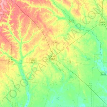
Name: Terrell County topographic map, elevation, terrain.

Location: Terrell County, Georgia, United States (31.62113 -84.60307 31.96747 -84.25850)

Average elevation: 338 ft

Minimum elevation: 203 ft

Maximum elevation: 554 ft

Gear up for your next adventure:

🛰️Satellite Messengers - Emergency SOS and two-way messaging for off-grid adventures
🧤Hiking Gloves - Protective gloves for rugged trails
🦶Hiking Gaiters - Keep debris and water out of your boots
😴Insulated Sleeping Pads - Compact and warm pads for high-elevation camping
🎁Geography Themed Gifts - Unique gift ideas for map lovers and geography enthusiasts

As an Amazon Associate, this site earns from qualifying purchases at no extra cost to you.