
Make a donation
Gear up for your next adventure:
As an Amazon Associate, this site earns from qualifying purchases at no extra cost to you.
Kheralu topographic map
Click on the map to display elevation.
Make a donation
Gear up for your next adventure:
As an Amazon Associate, this site earns from qualifying purchases at no extra cost to you.
Kheralu
Kheralu is located at 23°53′N 72°37′E / 23.88°N 72.62°E / 23.88; 72.62. It has an average elevation of 149 metres (488 feet).
Make a donation
Gear up for your next adventure:
As an Amazon Associate, this site earns from qualifying purchases at no extra cost to you.
About this map
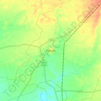
Name: Kheralu topographic map, elevation, terrain.
Location: Kheralu, Kheralu Taluka, Mahesana, Gujarat, 384325, India (23.84515 72.57723 23.92515 72.65723)
Average elevation: 564 ft
Minimum elevation: 492 ft
Maximum elevation: 646 ft
Make a donation
Gear up for your next adventure:
As an Amazon Associate, this site earns from qualifying purchases at no extra cost to you.