
Denkanikottai topographic map
Interactive map
Click on the map to display elevation.
About this map
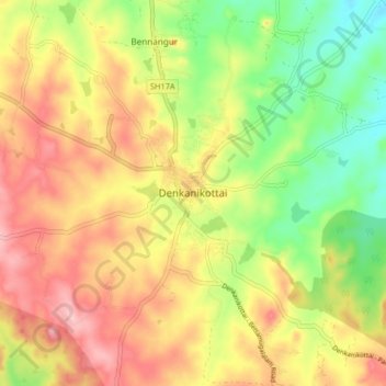
Name: Denkanikottai topographic map, elevation, terrain.
Location: Denkanikottai, Krishnagiri District, Tamil Nadu, 635107, India (12.48709 77.75262 12.56709 77.83262)
Average elevation: 2,861 ft
Minimum elevation: 2,585 ft
Maximum elevation: 3,127 ft