Geolocate

Mabalite topographic map

Click on the map to display elevation.

About this map

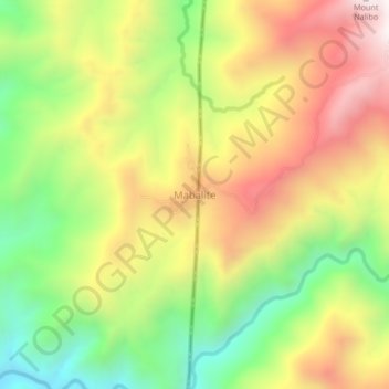
Name: Mabalite topographic map, elevation, terrain.

Location: Mabalite, Ilocos Sur, Ilocos Region, Philippines (17.03414 120.76156 17.07414 120.80156)

Average elevation: 2,995 ft

Minimum elevation: 1,473 ft

Maximum elevation: 4,619 ft

Gear up for your next adventure:

🧣Merino Neck Gaiters - Multi-functional headwear for wind and sun protection
🚪Portable Camp Chair - Foldable chair for comfort at camp
🎁Geography Themed Gifts - Unique gift ideas for map lovers and geography enthusiasts
🔥Plasma Lighters - Windproof lighters that work in any weather condition
🚗GPS Dash Cams - Record your scenic drives through mountain passes and canyons

As an Amazon Associate, this site earns from qualifying purchases at no extra cost to you.