
Thank you for supporting this site ❤️
Make a donation
Make a donation
Gear up for your next adventure:
As an Amazon Associate, this site earns from qualifying purchases at no extra cost to you.
Jabna topographic map
Click on the map to display elevation.
Thank you for supporting this site ❤️
Make a donation
Make a donation
Gear up for your next adventure:
As an Amazon Associate, this site earns from qualifying purchases at no extra cost to you.
About this map
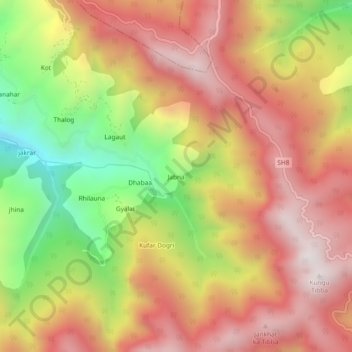
Name: Jabna topographic map, elevation, terrain.
Location: Jabna, Chaupal, Shimla, Himachal Pradesh, India (30.96751 77.49593 31.00751 77.53593)
Average elevation: 7,861 ft
Minimum elevation: 5,823 ft
Maximum elevation: 9,373 ft
Thank you for supporting this site ❤️
Make a donation
Make a donation
Gear up for your next adventure:
As an Amazon Associate, this site earns from qualifying purchases at no extra cost to you.