
Maple Cross topographic map
Click on the map to display elevation.
About this map
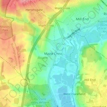
Name: Maple Cross topographic map, elevation, terrain.
Average elevation: 236 ft
Minimum elevation: 125 ft
Maximum elevation: 413 ft
Other topographic maps
Click on a map to view its topography, its elevation and its terrain.
Croxley Green
United Kingdom > England > Hertfordshire > Three Rivers > Rickmansworth
Average elevation: 220 ft
The Rookery
United Kingdom > England > Hertfordshire > Three Rivers > Abbots Langley > Langleybury
Average elevation: 302 ft
Oxhey Woods Local Nature Reserve
United Kingdom > England > Hertfordshire > Three Rivers > South Oxhey
Average elevation: 289 ft