Geolocate

Pampas topographic map

Click on the map to display elevation.

About this map

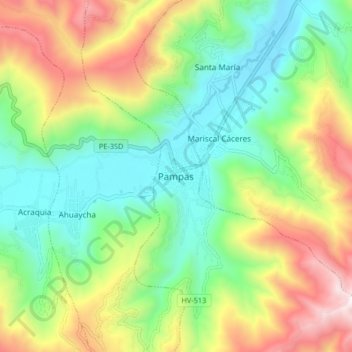
Name: Pampas topographic map, elevation, terrain.

Location: Pampas, Provincia de Tayacaja, Huancavelica, 09000, Perú (-12.43874 -74.90844 -12.35874 -74.82844)

Average elevation: 12,018 ft

Minimum elevation: 10,489 ft

Maximum elevation: 14,665 ft

Gear up for your next adventure:

🌲Outdoor Survival Books - Best books on survival skills
🥇GPS Hiking Watch - Multi‑sport GPS watch with navigation and trail tracking
🔥Fast-Boil Camping Stoves - Efficient cooking systems for quick trail meals
🏔️Mountain Trail Maps - High‑detail maps for popular peaks
🦟Ultrasonic Repellers - Create a bug-free zone at your camp or rest stop

As an Amazon Associate, this site earns from qualifying purchases at no extra cost to you.