
Thank you for supporting this site ❤️
Make a donation
Make a donation
Gear up for your next adventure:
As an Amazon Associate, this site earns from qualifying purchases at no extra cost to you.
Rosmaninhal topographic map
Click on the map to display elevation.
Thank you for supporting this site ❤️
Make a donation
Make a donation
Gear up for your next adventure:
As an Amazon Associate, this site earns from qualifying purchases at no extra cost to you.
About this map
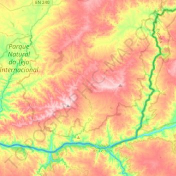
Name: Rosmaninhal topographic map, elevation, terrain.
Location: Rosmaninhal, Idanha-a-Nova, Castelo Branco, 6060-423, Portugal (39.65307 -7.26436 39.80816 -6.98727)
Average elevation: 876 ft
Minimum elevation: 367 ft
Maximum elevation: 1,355 ft
Thank you for supporting this site ❤️
Make a donation
Make a donation
Gear up for your next adventure:
As an Amazon Associate, this site earns from qualifying purchases at no extra cost to you.