
Thank you for supporting this site ❤️
Make a donation
Make a donation
Gear up for your next adventure:
As an Amazon Associate, this site earns from qualifying purchases at no extra cost to you.
Qingxu County topographic map
Click on the map to display elevation.
Thank you for supporting this site ❤️
Make a donation
Make a donation
Gear up for your next adventure:
As an Amazon Associate, this site earns from qualifying purchases at no extra cost to you.
About this map
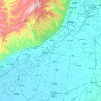
Name: Qingxu County topographic map, elevation, terrain.
Location: Qingxu County, Taiyuan City, Shanxi, China (37.44142 112.16293 37.78136 112.62041)
Average elevation: 2,995 ft
Minimum elevation: 2,451 ft
Maximum elevation: 6,070 ft
Thank you for supporting this site ❤️
Make a donation
Make a donation
Gear up for your next adventure:
As an Amazon Associate, this site earns from qualifying purchases at no extra cost to you.