Geolocate

Bagumbayan topographic map

Click on the map to display elevation.

About this map

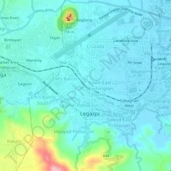
Name: Bagumbayan topographic map, elevation, terrain.

Location: Bagumbayan, Legazpi, Albay, Bicol Region, 4500, Philippines (13.12536 123.71337 13.16536 123.75337)

Average elevation: 105 ft

Minimum elevation: 7 ft

Maximum elevation: 617 ft

Gear up for your next adventure:

🎁Geography Themed Gifts - Unique gift ideas for map lovers and geography enthusiasts
🧥Waterproof Jacket for Hiking - Breathable and rugged rain jacket for outdoor excursions
📶Vehicle Signal Boosters - Improve reception in rural areas while driving to trailheads
📱Heavy-Duty Phone Cases - Drop-proof and waterproof protection for outdoor navigation
🏫Relief Map Kits - Hands-on tools for teaching landforms and elevation

As an Amazon Associate, this site earns from qualifying purchases at no extra cost to you.