Geolocate

Oxford topographic map

Click on the map to display elevation.

About this map

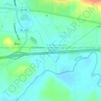
Name: Oxford topographic map, elevation, terrain.

Location: Oxford, Talladega County, Alabama, United States (33.58505 -85.91452 33.58572 -85.91409)

Average elevation: 607 ft

Minimum elevation: 554 ft

Maximum elevation: 787 ft

Talladega County trails, hiking, mountain biking, running and outdoor activities

Gear up for your next adventure:

Camping Coffee Makers - Enjoy premium coffee at the summit or campsite
📱Heavy-Duty Phone Cases - Drop-proof and waterproof protection for outdoor navigation
📦Dry Bags Set - Waterproof storage for electronics and clothes
🗺️Topographic Maps - Detailed topo maps for hiking, exploring and outdoor navigation
👖Convertible Hiking Pants - Versatile zip-off pants for changing altitudes and temperatures

As an Amazon Associate, this site earns from qualifying purchases at no extra cost to you.