Geolocate

Carranglan topographic map

Click on the map to display elevation.

About this map

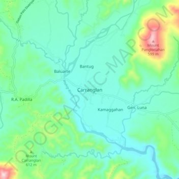
Name: Carranglan topographic map, elevation, terrain.

Location: Carranglan, Nueva Ecija, Central Luzon, Philippines (15.92066 121.02387 16.00066 121.10387)

Average elevation: 971 ft

Minimum elevation: 666 ft

Maximum elevation: 2,073 ft

Gear up for your next adventure:

🔦LED Headlamp - Bright and durable LED headlamp for night navigation
🎒Trekking Poles - Sturdy poles for balance and stability on rough terrain
🎁Geography Themed Gifts - Unique gift ideas for map lovers and geography enthusiasts
🚗GPS Dash Cams - Record your scenic drives through mountain passes and canyons
🔭Telescopic Hiking Pole - Adjustable pole for hiking stability

As an Amazon Associate, this site earns from qualifying purchases at no extra cost to you.