
Nachu topographic map
Interactive map
Click on the map to display elevation.
About this map
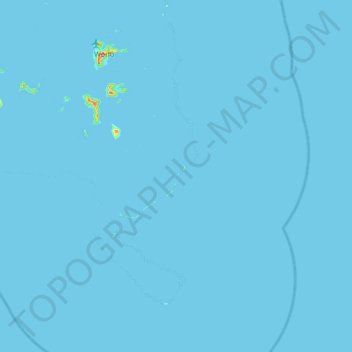
Name: Nachu topographic map, elevation, terrain.
Location: Nachu, Chuuk, Federated States of Micronesia (6.90039 151.67046 7.54039 152.31046)
Average elevation: 3 ft
Minimum elevation: -3 ft
Maximum elevation: 1,152 ft
Other topographic maps
Click on a map to view its topography, its elevation and its terrain.
Weno
Federated States of Micronesia > Chuuk
Weno, Chuuk, 96942, Federated States of Micronesia
Average elevation: 82 ft
Atkin
Federated States of Micronesia > Chuuk
Atkin, Chuuk, Federated States of Micronesia
Average elevation: 3 ft
Truk Lagoon
Federated States of Micronesia > Chuuk
Truk Lagoon, Chuuk, Federated States of Micronesia
Average elevation: 0 ft
Nomwin Atoll
Federated States of Micronesia > Chuuk
Nomwin Atoll, Chuuk, Federated States of Micronesia
Average elevation: 0 ft