
Madison topographic map
Click on the map to display elevation.
Madison
Madison is located at 33°35′17″N 83°28′21″W / 33.58806°N 83.47250°W / 33.58806; -83.47250 (33.588038, -83.472368). According to the United States Census Bureau, the city has a total area of 8.9 square miles (23 km2), of which, 8.9 square miles (23 km2) of it is land and 0.04 square miles (0.10 km2) of it (0.45%) is water. Madison is situated on a high ridge which traverses Morgan County from the northeast to the southwest at an elevation of 760 feet.
About this map
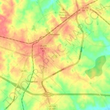
Name: Madison topographic map, elevation, terrain.
Location: Madison, Morgan County, Georgia, 30650, United States (33.54487 -83.51538 33.61875 -83.43872)
Average elevation: 640 ft
Minimum elevation: 512 ft
Maximum elevation: 738 ft
Morgan County trails, hiking, mountain biking, running and outdoor activities
Other topographic maps
Click on a map to view its topography, its elevation and its terrain.