Geolocate

Bon Air topographic map

Click on the map to display elevation.

About this map

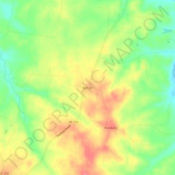
Name: Bon Air topographic map, elevation, terrain.

Location: Bon Air, Sumner County, Tennessee, United States (36.57477 -86.37805 36.61477 -86.33805)

Average elevation: 804 ft

Minimum elevation: 679 ft

Maximum elevation: 919 ft

Sumner County trails, hiking, mountain biking, running and outdoor activities

Gear up for your next adventure:

🪑Portable Camp Table - Compact table for campsite meals
🧥Waterproof Jacket for Hiking - Breathable and rugged rain jacket for outdoor excursions
🔦LED Headlamp - Bright and durable LED headlamp for night navigation
🚁Photography Drones - Capture stunning aerial views of landforms and topography
🧺Microfiber Travel Towels - Compact and fast-drying towels for trail use

As an Amazon Associate, this site earns from qualifying purchases at no extra cost to you.