
Thank you for supporting this site ❤️
Make a donation
Make a donation
Gear up for your next adventure:
As an Amazon Associate, this site earns from qualifying purchases at no extra cost to you.
Castedo topographic map
Click on the map to display elevation.
Thank you for supporting this site ❤️
Make a donation
Make a donation
Gear up for your next adventure:
As an Amazon Associate, this site earns from qualifying purchases at no extra cost to you.
About this map
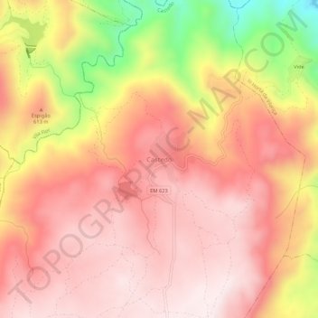
Name: Castedo topographic map, elevation, terrain.
Location: Castedo, Torre de Moncorvo, Distrito de Bragança, Portugal (41.21189 -7.19070 41.25189 -7.15070)
Average elevation: 1,854 ft
Minimum elevation: 610 ft
Maximum elevation: 2,451 ft
Thank you for supporting this site ❤️
Make a donation
Make a donation
Gear up for your next adventure:
As an Amazon Associate, this site earns from qualifying purchases at no extra cost to you.