Geolocate

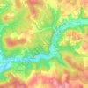
46150 topographic map

Click on the map to display elevation.

About this map

Name: 46150 topographic map, elevation, terrain.

Location: 46150, Catus, Cahors, Lot, Occitanie, France métropolitaine, France (44.49391 1.19127 44.62459 1.48311)

Average elevation: 761 ft

Minimum elevation: 285 ft

Maximum elevation: 1,319 ft

Other topographic maps

Click on a map to view its topography, its elevation and its terrain.

La Sole

France > Occitanie > Lot > Catus

Average elevation: 781 ft

La Berrie

France > Occitanie > Lot > Catus

Average elevation: 732 ft

Salvezou

France > Occitanie > Lot > Catus

Average elevation: 896 ft

Gear up for your next adventure:

🗃️Trail First Aid Kit - Essential kit for outdoor injuries and emergencies
🧭Pro Hiking Compasses - High-accuracy liquid-filled compasses for topographic orientation
📷Action Camera - Capture your outdoor adventures in HD
🕶️GPS Smartphone Mount - Secure mount for phone navigation
🏕️Family Camping Gear - Essentials for group camping trips

As an Amazon Associate, this site earns from qualifying purchases at no extra cost to you.