
Thank you for supporting this site ❤️
Make a donation
Make a donation
Gear up for your next adventure:
As an Amazon Associate, this site earns from qualifying purchases at no extra cost to you.
Houaïlou topographic map
Click on the map to display elevation.
Thank you for supporting this site ❤️
Make a donation
Make a donation
Gear up for your next adventure:
As an Amazon Associate, this site earns from qualifying purchases at no extra cost to you.
About this map
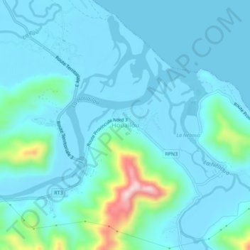
Name: Houaïlou topographic map, elevation, terrain.
Location: Houaïlou, Province Nord, Nouvelle-Calédonie, 98816, France (-21.29870 165.60705 -21.25870 165.64705)
Average elevation: 148 ft
Minimum elevation: -3 ft
Maximum elevation: 1,145 ft
Thank you for supporting this site ❤️
Make a donation
Make a donation
Gear up for your next adventure:
As an Amazon Associate, this site earns from qualifying purchases at no extra cost to you.