
Rockport topographic map
Click on the map to display elevation.
About this map
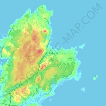
Name: Rockport topographic map, elevation, terrain.
Location: Rockport, Essex County, Massachusetts, 01966, United States (42.61565 -70.66032 42.69565 -70.58032)
Average elevation: 46 ft
Minimum elevation: -10 ft
Maximum elevation: 220 ft
Essex County trails, hiking, mountain biking, running and outdoor activities