Geolocate

Turtle Bayou topographic map

Click on the map to display elevation.

About this map

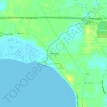
Name: Turtle Bayou topographic map, elevation, terrain.

Location: Turtle Bayou, Chambers County, Texas, 77597, United States (29.80717 -94.68742 29.84717 -94.64742)

Average elevation: 16 ft

Minimum elevation: -16 ft

Maximum elevation: 56 ft

Chambers County trails, hiking, mountain biking, running and outdoor activities

Other topographic maps

Click on a map to view its topography, its elevation and its terrain.

Anahuac

United States > Texas > Chambers County

Average elevation: 13 ft

Mont Belvieu

United States > Texas > Chambers County

Average elevation: 39 ft

Anahuac

United States > Texas > Chambers County

Average elevation: 16 ft

Mont Belvieu

United States > Texas > Chambers County

Average elevation: 39 ft

Beach City

United States > Texas > Chambers County

Average elevation: 10 ft

Cove

United States > Texas > Chambers County

Average elevation: 26 ft

Gear up for your next adventure:

📦Gear Storage Bags - Organize and protect outdoor equipment
🪶Survival Guide Book - Expert advice for emergency preparedness
🌧️Backpack Rain Cover - Keep gear dry in wet weather
Backpacking Tents - Weight-optimized shelters for multi-day topographic surveys
🧦Hiking Socks - Comfortable socks to prevent blisters on long hikes

As an Amazon Associate, this site earns from qualifying purchases at no extra cost to you.