
Thank you for supporting this site ❤️
Make a donation
Make a donation
Gear up for your next adventure:
As an Amazon Associate, this site earns from qualifying purchases at no extra cost to you.
Papayal topographic map
Click on the map to display elevation.
Thank you for supporting this site ❤️
Make a donation
Make a donation
Gear up for your next adventure:
As an Amazon Associate, this site earns from qualifying purchases at no extra cost to you.
About this map
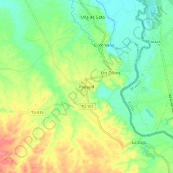
Name: Papayal topographic map, elevation, terrain.
Location: Papayal, Provincia de Zarumilla, Tumbes, Perú (-3.61136 -80.27458 -3.53136 -80.19458)
Average elevation: 128 ft
Minimum elevation: 33 ft
Maximum elevation: 272 ft
Thank you for supporting this site ❤️
Make a donation
Make a donation
Gear up for your next adventure:
As an Amazon Associate, this site earns from qualifying purchases at no extra cost to you.