
Thank you for supporting this site ❤️
Make a donation
Make a donation
Gear up for your next adventure:
As an Amazon Associate, this site earns from qualifying purchases at no extra cost to you.
Dietenhofen topographic map
Click on the map to display elevation.
Thank you for supporting this site ❤️
Make a donation
Make a donation
Gear up for your next adventure:
As an Amazon Associate, this site earns from qualifying purchases at no extra cost to you.
About this map
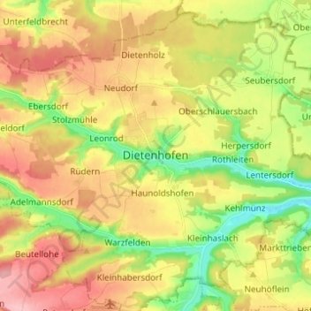
Name: Dietenhofen topographic map, elevation, terrain.
Location: Dietenhofen, Landkreis Ansbach, Bayern, 90599, Deutschland (49.36021 10.64853 49.44021 10.72853)
Average elevation: 1,286 ft
Minimum elevation: 1,070 ft
Maximum elevation: 1,509 ft
Thank you for supporting this site ❤️
Make a donation
Make a donation
Gear up for your next adventure:
As an Amazon Associate, this site earns from qualifying purchases at no extra cost to you.