
Thank you for supporting this site ❤️
Make a donation
Make a donation
Gear up for your next adventure:
As an Amazon Associate, this site earns from qualifying purchases at no extra cost to you.
Duffel topographic map
Click on the map to display elevation.
Thank you for supporting this site ❤️
Make a donation
Make a donation
Gear up for your next adventure:
As an Amazon Associate, this site earns from qualifying purchases at no extra cost to you.
About this map
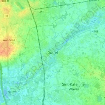
Name: Duffel topographic map, elevation, terrain.
Location: Duffel, Mechelen, Antwerpen, Vlaanderen, 2570, België (51.05572 4.46620 51.13572 4.54620)
Average elevation: 30 ft
Minimum elevation: -7 ft
Maximum elevation: 102 ft
Thank you for supporting this site ❤️
Make a donation
Make a donation
Gear up for your next adventure:
As an Amazon Associate, this site earns from qualifying purchases at no extra cost to you.