Geolocate

Aying topographic map

Click on the map to display elevation.

About this map

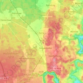
Name: Aying topographic map, elevation, terrain.

Location: Aying, Landkreis München, Bavaria, 85653, Germany (47.91593 11.70497 48.00339 11.85209)

Average elevation: 2,037 ft

Minimum elevation: 1,798 ft

Maximum elevation: 2,241 ft

Gear up for your next adventure:

🧭Hiking Compass - Precision compass for reliable navigation in the wilderness
📶Satellite Messenger - Communication device off‑grid
📖Nature Tracking Books - Learn to track wildlife and terrain
🪶Compact Camp Shovel - Folding shovel for campsite tasks
🧢Outdoor Hiking Hat - Sun protection hat for outdoor explorers

As an Amazon Associate, this site earns from qualifying purchases at no extra cost to you.