Geolocate

Seoho-myeon topographic map

Click on the map to display elevation.

About this map

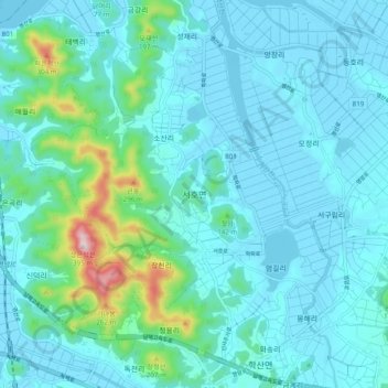
Name: Seoho-myeon topographic map, elevation, terrain.

Location: Seoho-myeon, Yeongam-gun, South Jeolla, 58437, South Korea (34.72688 126.53903 34.80688 126.61903)

Average elevation: 161 ft

Minimum elevation: -7 ft

Maximum elevation: 1,184 ft

Gear up for your next adventure:

🪶Wildlife Field Guides - Learn animal tracking and species ID
🌧️Backpack Rain Cover - Keep gear dry in wet weather
☀️Outdoor Sunscreen - High protection sunscreen for outdoor activities
🪶Compact Camp Shovel - Folding shovel for campsite tasks
🎒Outdoor Daypacks - Lightweight backpacks designed for carrying maps and essential gear

As an Amazon Associate, this site earns from qualifying purchases at no extra cost to you.