
Thank you for supporting this site ❤️
Make a donation
Make a donation
Gear up for your next adventure:
As an Amazon Associate, this site earns from qualifying purchases at no extra cost to you.
Pujilí topographic map
Click on the map to display elevation.
Thank you for supporting this site ❤️
Make a donation
Make a donation
Gear up for your next adventure:
As an Amazon Associate, this site earns from qualifying purchases at no extra cost to you.
About this map
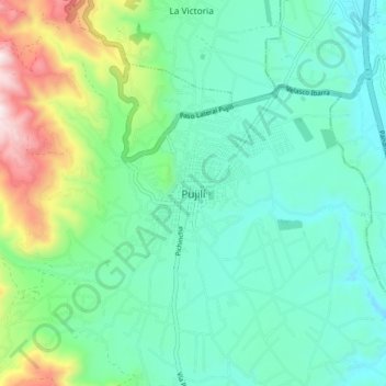
Name: Pujilí topographic map, elevation, terrain.
Location: Pujilí, Cotopaxi, 050401, Ecuador (-0.99614 -78.73559 -0.91614 -78.65559)
Average elevation: 9,957 ft
Minimum elevation: 9,301 ft
Maximum elevation: 11,985 ft
Thank you for supporting this site ❤️
Make a donation
Make a donation
Gear up for your next adventure:
As an Amazon Associate, this site earns from qualifying purchases at no extra cost to you.