Geolocate

Mananthavady topographic map

Click on the map to display elevation.

About this map

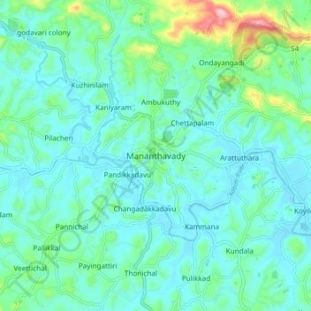
Name: Mananthavady topographic map, elevation, terrain.

Location: Mananthavady, Wayanad, Kerala, 670605, India (11.76103 75.96566 11.84103 76.04566)

Average elevation: 2,464 ft

Minimum elevation: 2,339 ft

Maximum elevation: 3,015 ft

Gear up for your next adventure:

🎒Waterproof Dry Bags - Keep your electronics and maps dry inside your pack
🌐World Map Poster - Decorative world maps with topographic info
🎒Day Hiking Backpack - Lightweight backpack perfect for day trips and outdoor adventures
Backpacking Tent - Lightweight and durable tent for multi‑day hikes
🛡️Bear Spray Outdoor - Protection in bear country hikes

As an Amazon Associate, this site earns from qualifying purchases at no extra cost to you.