
Thank you for supporting this site ❤️
Make a donation
Make a donation
Gear up for your next adventure:
As an Amazon Associate, this site earns from qualifying purchases at no extra cost to you.
Attrup topographic map
Click on the map to display elevation.
Thank you for supporting this site ❤️
Make a donation
Make a donation
Gear up for your next adventure:
As an Amazon Associate, this site earns from qualifying purchases at no extra cost to you.
About this map
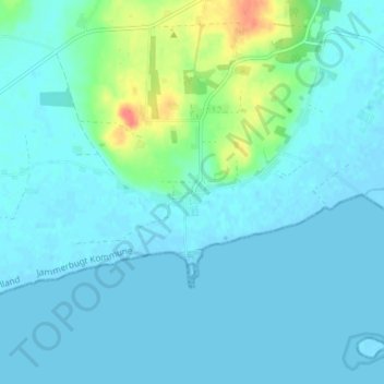
Name: Attrup topographic map, elevation, terrain.
Location: Attrup, Jammerbugt Municipality, North Denmark Region, Denmark (57.02613 9.43577 57.06613 9.47577)
Average elevation: 26 ft
Minimum elevation: -10 ft
Maximum elevation: 167 ft
Thank you for supporting this site ❤️
Make a donation
Make a donation
Gear up for your next adventure:
As an Amazon Associate, this site earns from qualifying purchases at no extra cost to you.