
Thank you for supporting this site ❤️
Make a donation
Make a donation
Gear up for your next adventure:
As an Amazon Associate, this site earns from qualifying purchases at no extra cost to you.
Sitzberg topographic map
Click on the map to display elevation.
Thank you for supporting this site ❤️
Make a donation
Make a donation
Gear up for your next adventure:
As an Amazon Associate, this site earns from qualifying purchases at no extra cost to you.
About this map
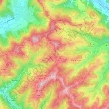
Name: Sitzberg topographic map, elevation, terrain.
Location: Sitzberg, Turbenthal, Bezirk Winterthur, Zürich, 8495, Schweiz (47.40420 8.89160 47.44420 8.93160)
Average elevation: 2,411 ft
Minimum elevation: 1,896 ft
Maximum elevation: 2,828 ft
Thank you for supporting this site ❤️
Make a donation
Make a donation
Gear up for your next adventure:
As an Amazon Associate, this site earns from qualifying purchases at no extra cost to you.