
漾濞县 topographic map
Interactive map
Click on the map to display elevation.
About this map
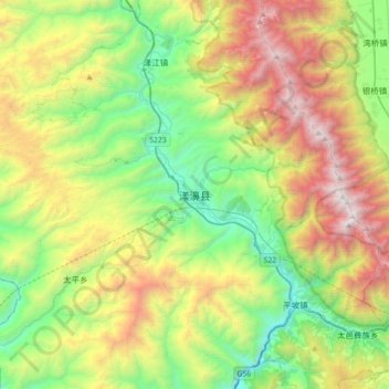
Name: 漾濞县 topographic map, elevation, terrain.
Location: 漾濞县, 漾濞彝族自治县, 大理白族自治州, 云南省, 中国 (25.51346 99.79708 25.83346 100.11708)
Average elevation: 7,641 ft
Minimum elevation: 4,393 ft
Maximum elevation: 13,363 ft
Other topographic maps
Click on a map to view its topography, its elevation and its terrain.