
Thank you for supporting this site ❤️
Make a donation
Make a donation
Gear up for your next adventure:
As an Amazon Associate, this site earns from qualifying purchases at no extra cost to you.
Sfissifa topographic map
Click on the map to display elevation.
Thank you for supporting this site ❤️
Make a donation
Make a donation
Gear up for your next adventure:
As an Amazon Associate, this site earns from qualifying purchases at no extra cost to you.
About this map
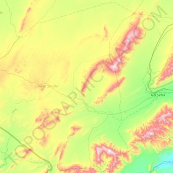
Name: Sfissifa topographic map, elevation, terrain.
Location: Sfissifa, Sfissifa District, Naâma, Algeria (32.50327 -1.35641 33.06556 -0.67057)
Average elevation: 4,377 ft
Minimum elevation: 3,337 ft
Maximum elevation: 6,926 ft
Thank you for supporting this site ❤️
Make a donation
Make a donation
Gear up for your next adventure:
As an Amazon Associate, this site earns from qualifying purchases at no extra cost to you.