
Thank you for supporting this site ❤️
Make a donation
Make a donation
Gear up for your next adventure:
As an Amazon Associate, this site earns from qualifying purchases at no extra cost to you.
Chilloroya topographic map
Click on the map to display elevation.
Thank you for supporting this site ❤️
Make a donation
Make a donation
Gear up for your next adventure:
As an Amazon Associate, this site earns from qualifying purchases at no extra cost to you.
About this map
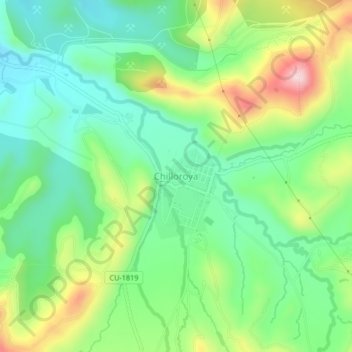
Name: Chilloroya topographic map, elevation, terrain.
Location: Chilloroya, Velille, Chumbivilcas, Cusco, Perú (-14.51517 -71.79755 -14.47517 -71.75755)
Average elevation: 13,396 ft
Minimum elevation: 13,051 ft
Maximum elevation: 14,049 ft
Thank you for supporting this site ❤️
Make a donation
Make a donation
Gear up for your next adventure:
As an Amazon Associate, this site earns from qualifying purchases at no extra cost to you.