Geolocate

Vauban topographic map

Click on the map to display elevation.

About this map

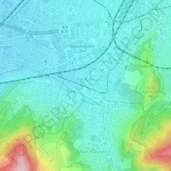
Name: Vauban topographic map, elevation, terrain.

Location: Vauban, Freiburg im Breisgau, Baden-Württemberg, Germany (47.97216 7.81624 47.97832 7.83103)

Average elevation: 978 ft

Minimum elevation: 801 ft

Maximum elevation: 1,683 ft

Other topographic maps

Click on a map to view its topography, its elevation and its terrain.

Gear up for your next adventure:

🗃️Trail First Aid Kit - Essential kit for outdoor injuries and emergencies
🪵Folding Camp Saw - Compact saw for wood and campsite work
🍳Camping Cook Set - Complete cookware for outdoor meals
⛑️Personal Locator Beacon - Safety beacon for emergencies
🪶Paracord Bracelet - Survival bracelet with built‑in tools

As an Amazon Associate, this site earns from qualifying purchases at no extra cost to you.