
Thank you for supporting this site ❤️
Make a donation
Make a donation
Gear up for your next adventure:
As an Amazon Associate, this site earns from qualifying purchases at no extra cost to you.
Randa topographic map
Click on the map to display elevation.
Thank you for supporting this site ❤️
Make a donation
Make a donation
Gear up for your next adventure:
As an Amazon Associate, this site earns from qualifying purchases at no extra cost to you.
About this map
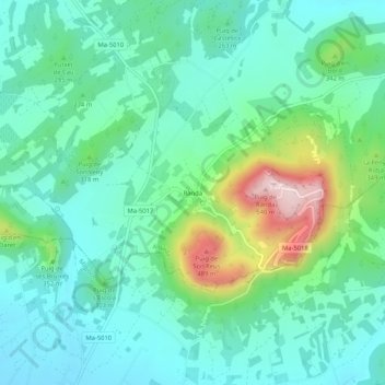
Name: Randa topographic map, elevation, terrain.
Location: Randa, Algaida, Pla de Mallorca, Islas Baleares, 07210, España (39.50676 2.89504 39.54676 2.93504)
Average elevation: 863 ft
Minimum elevation: 561 ft
Maximum elevation: 1,788 ft
Thank you for supporting this site ❤️
Make a donation
Make a donation
Gear up for your next adventure:
As an Amazon Associate, this site earns from qualifying purchases at no extra cost to you.