
Thank you for supporting this site ❤️
Make a donation
Make a donation
Gear up for your next adventure:
As an Amazon Associate, this site earns from qualifying purchases at no extra cost to you.
Frick topographic map
Click on the map to display elevation.
Thank you for supporting this site ❤️
Make a donation
Make a donation
Gear up for your next adventure:
As an Amazon Associate, this site earns from qualifying purchases at no extra cost to you.
About this map
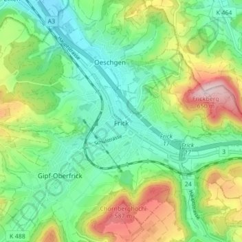
Name: Frick topographic map, elevation, terrain.
Location: Frick, Bezirk Laufenburg, Aargau, 5070, Switzerland (47.48811 7.97818 47.52765 8.04640)
Average elevation: 1,391 ft
Minimum elevation: 1,040 ft
Maximum elevation: 2,103 ft
Thank you for supporting this site ❤️
Make a donation
Make a donation
Gear up for your next adventure:
As an Amazon Associate, this site earns from qualifying purchases at no extra cost to you.