
Thank you for supporting this site ❤️
Make a donation
Make a donation
Gear up for your next adventure:
As an Amazon Associate, this site earns from qualifying purchases at no extra cost to you.
Lubartów topographic map
Click on the map to display elevation.
Thank you for supporting this site ❤️
Make a donation
Make a donation
Gear up for your next adventure:
As an Amazon Associate, this site earns from qualifying purchases at no extra cost to you.
About this map
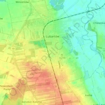
Name: Lubartów topographic map, elevation, terrain.
Location: Lubartów, Lubartów County, Lublin Voivodeship, 21-100, Poland (51.43393 22.56957 51.48289 22.64221)
Average elevation: 528 ft
Minimum elevation: 469 ft
Maximum elevation: 597 ft
Thank you for supporting this site ❤️
Make a donation
Make a donation
Gear up for your next adventure:
As an Amazon Associate, this site earns from qualifying purchases at no extra cost to you.