Geolocate

Siguatepeque topographic map

Click on the map to display elevation.

About this map

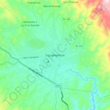
Name: Siguatepeque topographic map, elevation, terrain.

Location: Siguatepeque, Comayagua, 12111, Honduras (14.55781 -87.87531 14.63781 -87.79531)

Average elevation: 3,819 ft

Minimum elevation: 3,294 ft

Maximum elevation: 5,269 ft

Gear up for your next adventure:

🛡️Insect Repellent - Protection against bugs during outdoor activities
🧭Outdoor Navigation Book - Learn advanced navigation skills
🔭Telescopic Hiking Pole - Adjustable pole for hiking stability
🪓Survival Multi‑Tool - Versatile tool for camp and trail tasks
🧤Tactile Hiking Gloves - Keep hands warm while operating GPS and smartphone screens

As an Amazon Associate, this site earns from qualifying purchases at no extra cost to you.