
朝阳市 topographic map
Interactive map
Click on the map to display elevation.
About this map
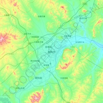
Name: 朝阳市 topographic map, elevation, terrain.
Location: 朝阳市, 双塔区, 朝阳市, 辽宁省, 122000, 中国 (41.41548 120.27907 41.73548 120.59907)
Average elevation: 938 ft
Minimum elevation: 459 ft
Maximum elevation: 2,536 ft
Other topographic maps
Click on a map to view its topography, its elevation and its terrain.