
St. Lorenzen topographic map
Interactive map
Click on the map to display elevation.
St. Lorenzen
Die komplette Liste der Statistik Austria ist in: Topographische Siedlungskennzeichnung nach STAT
About this map
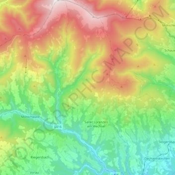
Name: St. Lorenzen topographic map, elevation, terrain.
Location: St. Lorenzen, Hartberg-Fürstenfeld, Steiermark, Österreich (47.40434 15.91084 47.53002 15.98862)
Average elevation: 3,100 ft
Minimum elevation: 1,499 ft
Maximum elevation: 5,699 ft