
Thank you for supporting this site ❤️
Make a donation
Make a donation
Gear up for your next adventure:
As an Amazon Associate, this site earns from qualifying purchases at no extra cost to you.
Watamu topographic map
Click on the map to display elevation.
Thank you for supporting this site ❤️
Make a donation
Make a donation
Gear up for your next adventure:
As an Amazon Associate, this site earns from qualifying purchases at no extra cost to you.
About this map
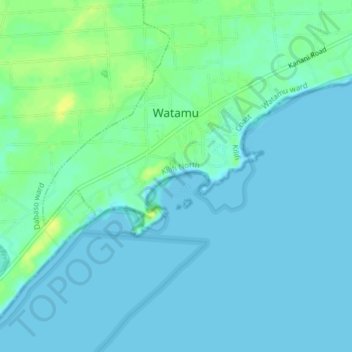
Name: Watamu topographic map, elevation, terrain.
Location: Watamu, Kilifi North, Kilifi County, Coast, Kenya (-3.37524 39.99112 -3.33871 40.02977)
Average elevation: 16 ft
Minimum elevation: -7 ft
Maximum elevation: 66 ft
Thank you for supporting this site ❤️
Make a donation
Make a donation
Gear up for your next adventure:
As an Amazon Associate, this site earns from qualifying purchases at no extra cost to you.