
Thank you for supporting this site ❤️
Make a donation
Make a donation
Gear up for your next adventure:
As an Amazon Associate, this site earns from qualifying purchases at no extra cost to you.
Ararat topographic map
Click on the map to display elevation.
Thank you for supporting this site ❤️
Make a donation
Make a donation
Gear up for your next adventure:
As an Amazon Associate, this site earns from qualifying purchases at no extra cost to you.
About this map
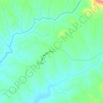
Name: Ararat topographic map, elevation, terrain.
Location: Ararat, Patrick County, Virginia, 24053, United States (36.57903 -80.53062 36.61903 -80.49062)
Average elevation: 1,394 ft
Minimum elevation: 1,207 ft
Maximum elevation: 2,051 ft
Patrick County trails, hiking, mountain biking, running and outdoor activities
Thank you for supporting this site ❤️
Make a donation
Make a donation
Gear up for your next adventure:
As an Amazon Associate, this site earns from qualifying purchases at no extra cost to you.