Geolocate

Mount Etna topographic map

Click on the map to display elevation.

About this map

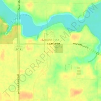
Name: Mount Etna topographic map, elevation, terrain.

Location: Mount Etna, Huntington County, Indiana, United States (40.73449 -85.56415 40.74478 -85.55461)

Average elevation: 804 ft

Minimum elevation: 735 ft

Maximum elevation: 853 ft

Huntington County trails, hiking, mountain biking, running and outdoor activities

Other topographic maps

Click on a map to view its topography, its elevation and its terrain.

Mahon

United States > Indiana > Huntington County

Average elevation: 781 ft

Mahon

United States > Indiana > Huntington County

Average elevation: 781 ft

Gear up for your next adventure:

🍳Camping Cook Set - Complete cookware for outdoor meals
🎒Hydration Pack - Hands‑free water reservoir for long hikes
📶Vehicle Signal Boosters - Improve reception in rural areas while driving to trailheads
🛡️Insect Repellent - Protection against bugs during outdoor activities
🧯Portable Fire Pit - Compact fire pit for camping spots

As an Amazon Associate, this site earns from qualifying purchases at no extra cost to you.