Geolocate

Bogo topographic map

Click on the map to display elevation.

About this map

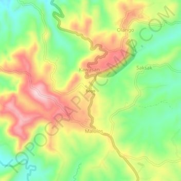
Name: Bogo topographic map, elevation, terrain.

Location: Bogo, Aloguinsan, Cebu, Central Visayas, 6040, Philippines (10.14985 123.54313 10.18985 123.58313)

Average elevation: 512 ft

Minimum elevation: 131 ft

Maximum elevation: 942 ft

Gear up for your next adventure:

🛠️Outdoor Gear Repair Kit - Essential tools to fix gear on the trail
🗃️Trail First Aid Kit - Essential kit for outdoor injuries and emergencies
🥾Women's Hiking Boots - Top-rated trail boots with ankle support and superior grip
🧭Map Reading Tools - Tools and kits for map navigation
GPS Sports Watch - GPS watch for running, hiking and training

As an Amazon Associate, this site earns from qualifying purchases at no extra cost to you.