
Thank you for supporting this site ❤️
Make a donation
Make a donation
Gear up for your next adventure:
As an Amazon Associate, this site earns from qualifying purchases at no extra cost to you.
Beledweyne topographic map
Click on the map to display elevation.
Thank you for supporting this site ❤️
Make a donation
Make a donation
Gear up for your next adventure:
As an Amazon Associate, this site earns from qualifying purchases at no extra cost to you.
About this map
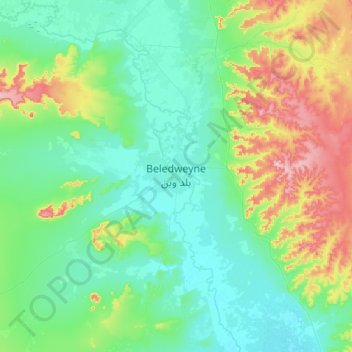
Name: Beledweyne topographic map, elevation, terrain.
Location: Beledweyne, Beledweyne District, Hiiraan, Hirshabelle, Somalia (4.57677 45.04389 4.89677 45.36389)
Average elevation: 728 ft
Minimum elevation: 577 ft
Maximum elevation: 1,184 ft
Thank you for supporting this site ❤️
Make a donation
Make a donation
Gear up for your next adventure:
As an Amazon Associate, this site earns from qualifying purchases at no extra cost to you.