
Thank you for supporting this site ❤️
Make a donation
Make a donation
Gear up for your next adventure:
As an Amazon Associate, this site earns from qualifying purchases at no extra cost to you.
2629 topographic map
Click on the map to display elevation.
Thank you for supporting this site ❤️
Make a donation
Make a donation
Gear up for your next adventure:
As an Amazon Associate, this site earns from qualifying purchases at no extra cost to you.
About this map
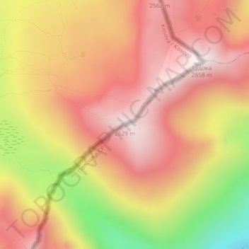
Name: 2629 topographic map, elevation, terrain.
Location: 2629, Municipality of Dragash / Dragaš, Kosovo (41.91159 20.76505 41.91169 20.76515)
Average elevation: 7,536 ft
Minimum elevation: 5,594 ft
Maximum elevation: 8,691 ft
Thank you for supporting this site ❤️
Make a donation
Make a donation
Gear up for your next adventure:
As an Amazon Associate, this site earns from qualifying purchases at no extra cost to you.