
Aylesford Lake topographic map
Interactive map
Click on the map to display elevation.
About this map
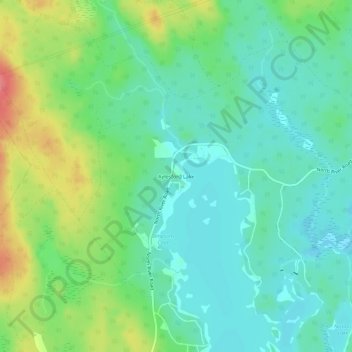
Name: Aylesford Lake topographic map, elevation, terrain.
Average elevation: 735 ft
Minimum elevation: 653 ft
Maximum elevation: 919 ft
Other topographic maps
Click on a map to view its topography, its elevation and its terrain.
Aylesford Lake
Canada > Nova Scotia > Aylesford Lake
Aylesford Lake, Hilltop Lane, Aylesford Lake, Municipality of the County of Kings, Kings County, Nova Scotia, Canada
Average elevation: 702 ft