
Wangen topographic map
Click on the map to display elevation.
Wangen
Wangen liegt auf einer Anhöhe eingebettet zwischen dem Forstenrieder Park im Norden und dem früher gemeindefreien Gebiet der Wadlhauser Gräben, einem sehr hügeligen zusammenhängenden Waldgebiet, im Süden. Dazwischen verläuft unmittelbar am südlichen Ortsrand die A 952 vorbei.
About this map
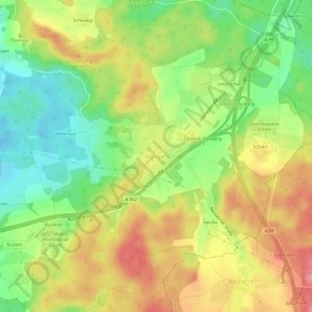
Name: Wangen topographic map, elevation, terrain.
Location: Wangen, Starnberg, Landkreis Starnberg, Bayern, Deutschland (47.99140 11.38259 48.03140 11.42259)
Average elevation: 2,093 ft
Minimum elevation: 1,923 ft
Maximum elevation: 2,270 ft