
Thank you for supporting this site ❤️
Make a donation
Make a donation
Gear up for your next adventure:
As an Amazon Associate, this site earns from qualifying purchases at no extra cost to you.
Altenmünster topographic map
Click on the map to display elevation.
Thank you for supporting this site ❤️
Make a donation
Make a donation
Gear up for your next adventure:
As an Amazon Associate, this site earns from qualifying purchases at no extra cost to you.
About this map
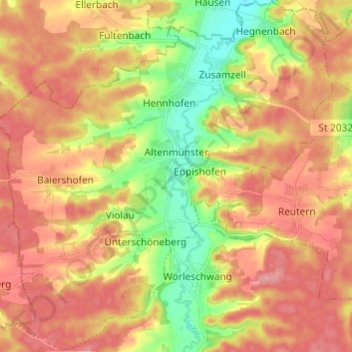
Name: Altenmünster topographic map, elevation, terrain.
Location: Altenmünster, Landkreis Augsburg, Bayern, 86450, Deutschland (48.41889 10.52792 48.49921 10.64556)
Average elevation: 1,598 ft
Minimum elevation: 1,394 ft
Maximum elevation: 1,755 ft
Thank you for supporting this site ❤️
Make a donation
Make a donation
Gear up for your next adventure:
As an Amazon Associate, this site earns from qualifying purchases at no extra cost to you.