
Make a donation
Gear up for your next adventure:
As an Amazon Associate, this site earns from qualifying purchases at no extra cost to you.
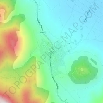
Levidi topographic map
Click on the map to display elevation.
Make a donation
Gear up for your next adventure:
As an Amazon Associate, this site earns from qualifying purchases at no extra cost to you.
Levidi
Levidi (Greek: Λεβίδι) is a small town and a former municipality in Arcadia, Peloponnese, Greece. Since the 2011 local government reform it is part of the municipality Tripoli, of which it is a municipal unit. The municipal unit has an area of 312.641 km2. The town is situated on the northeastern slope of the Mainalo mountains, at about 850 m elevation. Levidi is 9 km northwest of Kapsas, 10 km east of Vytina, 12 km southwest of Kandila and 20 km northwest of Tripoli. It is at the junction of the Greek National Road 74 (Tripoli–Pyrgos) and the Greek National Road 66 (Levidi - Nemea).
Make a donation
Gear up for your next adventure:
As an Amazon Associate, this site earns from qualifying purchases at no extra cost to you.
About this map
Name: Levidi topographic map, elevation, terrain.
Average elevation: 3,068 ft
Minimum elevation: 2,192 ft
Maximum elevation: 5,377 ft
Make a donation
Gear up for your next adventure:
As an Amazon Associate, this site earns from qualifying purchases at no extra cost to you.